

Orthomosic Mapping
Experience the precision and efficiency of our orthomosaic mapping services, specifically tailored for construction projects. Our advanced drone technology captures high-resolution aerial images and stitches them together to create detailed, accurate maps. These maps are invaluable for monitoring site progress, planning, and decision-making.
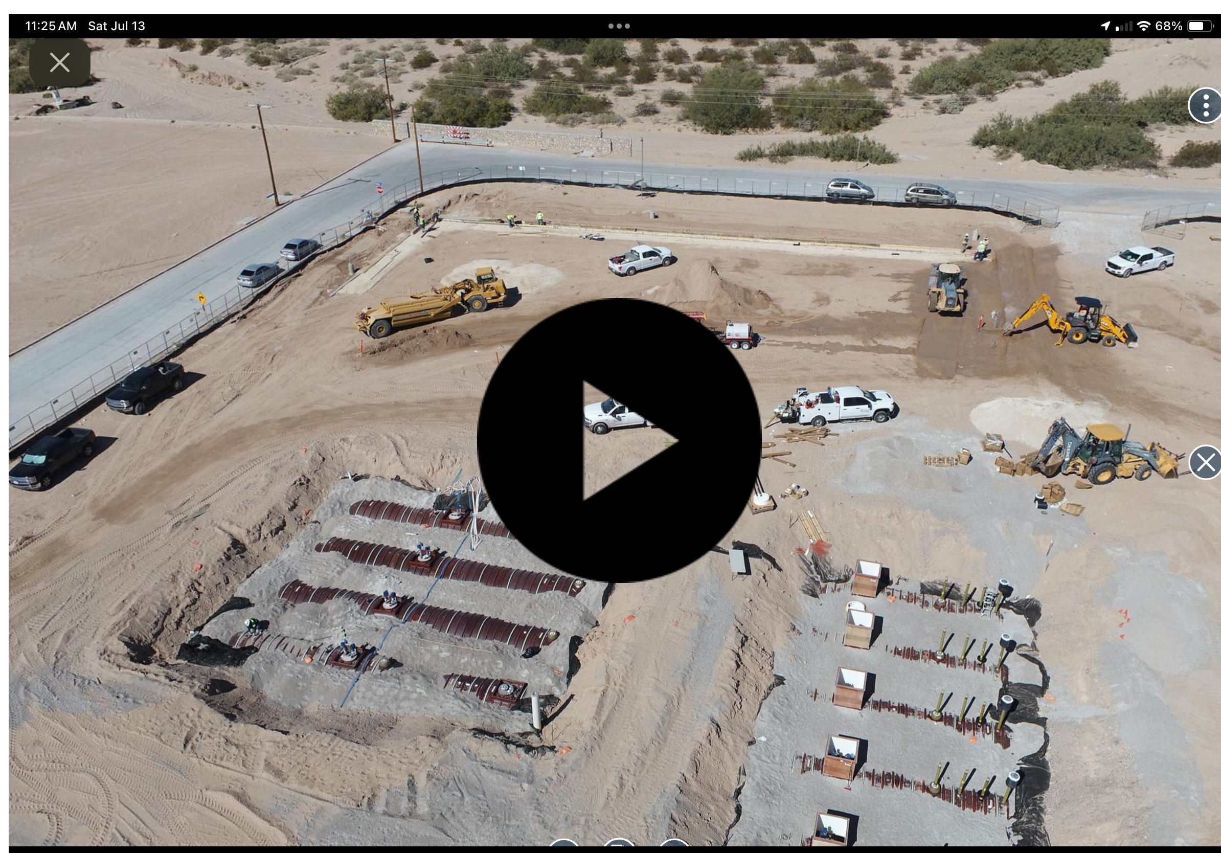
Progress Reports

Enhance your projects with our thorough progress reports embedded with insightful data. Our detailed reports offer a comprehensive view of your construction site's progress, allowing for better tracking and management. Discover a new level of project management with Apex SkyCam, where precision and clarity drive your project's success. With our high-resolution imagery and precise mapping, you can make informed decisions and communicate effectively with your team and stakeholders.

Stockpile Measurements
Accurately know how many cubic yards are in a particular pile of aggregate with our advanced stockpile measurement technology. This game-changing service provides precise data, allowing you to streamline logistics and optimize resource management. With Apex SkyCam, you can confidently manage inventory, reduce costs, and improve overall efficiency.

Interior Captures
We capture interiors with a drone fly-through, which is ideal for larger-scale warehouses and expansive indoor spaces. This cutting-edge technology ensures thorough and accurate documentation of your project's interior layout and conditions. With Apex SkyCam, you can achieve detailed visual records that enhance planning, reporting, and overall project management.

Roof Inspections
Drone roof inspections provide safe, efficient, and detailed assessments, significantly reducing the need for manual inspections. This advanced technology quickly identifies potential issues, minimizing risks associated with traditional inspection methods. By leveraging drone inspections, you save time and costs, ensuring timely maintenance and repairs while enhancing overall safety and operational efficiency.
AERIAL 360°
360° pictures on construction sites provide comprehensive views, greatly enhancing project monitoring and documentation. This immersive technology boosts inspection efficiency by offering a complete visual perspective, allowing for early identification of issues. By integrating 360° imagery into your workflow, you save time and costs, ensuring smoother project management and more informed decision-making.